 Mount Korbu, the second highest mountain in Peninsular Malaysia at 2183 m. Also seen is the steep Chuban Wall which is part of the slopes of Mount Korbu.
On the 16th of November 2004, the mountaineering expedition group consisting of myself, Ian, Peter, Adam and Alex set out for our first attempt of a "real" mountain, our first serious mountaineering expedition. We were heading to the infamous Gunung Korbu. For first time, not too much experience trekkers, our attempt on Gunung Korbu is a little bit too ambitious, equivalent to someone who has not climbed above 1000m attempting Mount Everest's 8848m. We boarded the KTM long distance train to Ipoh just after dinner time. Over in Ipoh we met our guide for the first time, Salan who works under Mr. Muzs company. Salan is a honest looking guide who is small in physique but nevertheless boast an impressive resume of climbing nearly all the major peaks in the Titiwangsa Range including completing the infamous G7 Series, which is a series of 7 of the highest mountains in Peninsular Malaysia. After the previous bad experience with Mr.Jeff (the dishonest guide in Cameron Highlands) I was really praying hard to get an honest and responsible guide. Musz drove us all in his 4WD to the trailhead which is located about an hours drive away from downtown Ipoh. The trailhead was dark as there was no electricity, so we could see the entire universe of stars that lit up the night...truly a sight to behold! There we stayed by a hut next to the river for the night in open air facing the star lit night sky. We had to get some good night sleep although in reality it was actually more of a challenge than I had thought, with all the mosquitoes, loud snoring, the occasional whiskering noise etc...
When the sun came up the next morning, we packed up and got ready to start our expedition to Korbu's summit which is expected to be a 4 day 3 night affair, provided everything turns out well. We started by crossing our first river. The current of the river was actually faster than I expected and it did give us some challenging moments while crossing it. Not to forget it made us start off so early in the journey with our socks and shoes soaking wet. This caused our shoes to make the annoying "quacking" noise while walking and also increase our risk of getting blistered feet!
 The Orang Asli village.
Not too long after that we came across an Orang Asli village. The Orang Asli houses were made of bamboos and nipah leaves as well as wild wood gathered from the jungle. However the entire village was empty as they had been told to evacuate the area because the Perak government is building a dam that would eventually flood the entire village. We continued for a little bit before reaching our first stop where we took some breakfast snacks. At this site we could already see leaches trying to crawl up on us to also have their "bloody breakfast".
We then continued uphill on an area called Bukit Nenas aka Pineapple Hill. This hill was our first major uphill task at which we were already complaining about the long and tiring trek. However, according to the guide, Salan, this is only the appetizer as the "main course" has yet to come!
 Taking a dip in the river.
After trekking for a few good hours we came to a riverside where all of us took the opportunity to take a dip in the river. It felt so refreshing especially after the long trek on Bukit Nenas. Upon refreshing ourselves, we toiled on towards the direction of the campsite, Kem Seroja. Now we were presented with a more challenging trek, climbing up Bukit Penat. The trek up Bukit Penat was definitely more tiring than that of Bukit Nenas hence its name. As first timers attempting such a "hardcore" mountain, we were struggling on this hill quite badly. After a few more hours toiling up Bukit Penat we reach yet another hill called Bukit Lagi Penat!! Yeah, that's right...the name doesn't help motivate anyone of us who are already drained out of our valuable energy! Bukit Lagi Penat definitely lives up to its name because the trek along this hill is a steep scree all the way up. It really took its toll on my leg and knee muscles given that we have to carry our huge backpacks which was already as heavy as another human being! This was definitely no easy task and it really pushed all of us to our physical and mental limits!
 Resting on the slopes of Bukit Lagi Penat. Clockwise from left back: Keith, Shanaz, Salan, Ian, Adam, Alex.
After a few hours toiling on the trek to Kem Seroja, we reached a slope which was almost like a cliffhanger. A large tree had fallen down probably due to being struck by lightning, hence it caused a mini landslide around the entire slope making it even steeper. The undergrowth was so thick and wild it did not help in providing an easy passage either. The guide Salan and 2 other people who were trekking with us, Sharul and his girlfriend Shanaz climbed above first to clear the undergrowth with their parangs. Then disaster struck! Sharul fell a few meters from the fallen tree branch while using it to climb up the cliff. He tumbled down the cliff and in the process, broke his collar bone. It was ugly and messy and bloody. I don't want to go into the details but Sharul was writhing in deep pain and would definitely not be able to continue on for another 4 more days in this condition. So we were now faced with a challenging situation of whether to turn back or head on. Finally Salan the guide proposed that he will take Sharul accompanied by his girlfriend Shanaz back to the trailhead and go to Ipoh town to the nearest hospital to treat his injury. However, he would lead us to Kem Seroja (since its not too far away from where we are) first before heading out to Ipoh. That means the 5 of us will spend the night at the campsite without the guide and the other two people as they will trek through the night to head out to Ipoh. The plan is that Salan will then immediately trek back to Kem Seroja early in the morning to meet up with us to continue our journey in the evening. Not long from the site of the accident we finally reached Kem Seroja which is a patch of cleared land by the river. This will be our campsite for the night.
 Bathing in the river by Kem Seroja.
By this time, we were all extremely exhausted and demotivated! The tonnes of vampire leaches feasting on us didn't help boost our depleted morale either! Alex was freaked out by the amount of leaches that was around the area ( you could actually see them happily crawling towards your feet), he went straight into camp and swore never to come out of it again. Adam on the other hand was bitten quite badly by the leaches and even had one glued on his ass. Peter did the task of helping Adam rid off the leach from his ass as Adam was screaming away like a nervous wreck. Then came Peter who realized that there were 2 leaches attached to his...ehem...ehem...balls. Peter was more composed emotionally but nevertheless found it surprising on how these leaches sneaked up his pants and underwear to happily suck on his testicles. When asked how did he feel about leaches ravaging his modesty Peter cooly replied "The leaches are impressed by how huge IT is that it would like to suck till it achieves that size too". I too and Ian had our fair bit of leach bites all over our legs and thankfully not in any other more private places. I felt so exhausted and disgusted from all those bloody leach bite stains that I was so tempted to jump into the river for a bath despite the water being almost freezingly cold! So I jumped in to take a dip. Physically I was not prepared for such a cold bath but mentally I was, as I used some Zen Buddhist meditation skills to calm my mind down although my body was shivering vigorously like some one having a serious fit. To be honest, my balls even shrank to the point where I couldn't even feel it anymore! I was so disbelieved that I had to check its existence a few times before being convinced I was still a man. That was the coldest and most tormenting bath I've ever had up till now which I will never forget!
That night the five of us had a heart to heart talk about how we felt about this expedition so far and our plans for the next day. Severe exhaustion, Sharul's accident and the continuous blood pouring out from the leach bites (leaches inject an anti-blood clot chemical which prevents blood from becoming hard and eventually stop flowing out of the body) did a huge blow to our morale and our excitement in attempting our first major summit was fast waning. Adam and Alex eventually voiced their strong intention of not wanting to continue the journey and turning back home instead. It really was something that split the team apart. Ian and I were also beaten up by the day's trek and were equally exhausted and traumatized but there was still a burning desire in us to reach the summit of Gunung Korbu. We kept a glimmer of hope that the next day might be better off with some good night rest which would hopefully make us more refreshed & energetic. Peter was the calm man in the middle who could easily continue on with the journey to the top but he too opted to turn back on grounds that he felt responsible to accompany Alex and Adam who were actually foreigners from Britain and Taiwan respectively back home to KL.
The next day at about noon, a tired Salan met us up in Kem Seroja, obviously lacking of sleep as he trekked through the night to the trailhead and then back towards Kem Seroja. The five of us voiced out our decision to turn back since there were 3 votes of turning back to 2. Salan was surprised to hear that but eventually realized the condition and emotional torment some of us faced. He agreed to take us back down the mountain. Then hope came, not too long later, another expedition of Chinese trekkers led by another of Muzs' guides Arman and Budu showed up at Kem Seroja. There were at least 8 of them in the group. The leader of the group was a lady called Miss Yap. She was quite attractive for a hardcore trekker and has surprisingly smooth, silky and white legs (I wonder why the leaches don't get attracted to her?). The arrival of this group was an opportunity for me and Ian to climb to the summit of Gunung Korbu. We negotiated with the arriving group and they allowed us to join in their expedition to the top of Korbu. With this, the differences had been settled and everyone got what they wanted. Ian and I could go up to Korbu while Peter, Alex and Adam could go down the mountain with Salan.
That evening, we bid farewell to the quartet who will be going down the mountain the next day while we head on to Kem Kijang which is just 2 hours away from Kem Seroja. Kem Kijang or also known as Kem Agas (Agas= sandfly in Malay) is a small campsite also by the river which has a more wild feel thanks to the roots of the trees jutting out and growing out of proportions here and there. However, the main thing that will draw ones attention in Kem Kijang is none other than its tons of sandflies. A sandfly bite is nothing fun at all and is definitely an experience not to remember! The bites are very very itchy and it swells up badly as a result of uncontrollable scratching. The experience in Kem Kijang was truly a nightmare as we did not get any sleep at all thanks to the constant biting of the sandflies through out the night. All we did the whole night was scratching away! Just as an additional note: the sandfly bites gave rise to ugly scars that lasted for quite a long time before it eventually healed. My leg looked like that of a leper for at least a year!
 The view of Puncak Chuban from the ridge.
The next day arrived. Today we will be heading all the way up to the summit of Gunung Korbu. I actually started to fear this mountain given the past few days of torment and I was quite worried about the torments that have yet to come. Now I understand the sort of respect a mountain like Gunung Korbu demands and deservedly should get. The trek was a steep way up up and up to a hill called Puncak Botak (due to an opening on its peak). Before heading up to Puncak Botak we stopped by a place called Last Waterpoint, so named because it is the last point in the trek where we could collect drinkable natural water from the stream. Over here we filled up our tanks for usage on the top of Korbu. This would also mean bearing more weight due to the full water reserves. A couple of hours toiling and we finally reached Puncak Botak at which we could see the road that lies ahead, Gunung Korbu's false summits. This is also the mountain proper as all this while we had been trekking just to get to the mountain itself! Can you imagine the suffering we had gone through even before reaching the mountain proper?!
 Climbing the almost vertical Chuban Wall.
From Puncak Botak it was a trek all along a narrow ridge which has at least a 1000m drop on each side, but the heavy vegetation blocked most of the view along the ridge so we couldn't really see how deep the drop is if we were to fall down from there. Then came arguably the most nerve wrecking part of the journey, the "Chuban Wall". The Chuban Wall lies on the face of Puncak Chuban which is one of the many false peaks of Gunung Korbu. What makes it so challenging and nerve wrecking is that its an almost vertical slope of granite at which if you look down you could see the more than 1000m drop down the mountain. There were fixed ropes to facilitate the climb up the Chuban Wall. As expected, it was a slow crawl along the Chuban Wall as none of us want to make a misstep which could send us plunging down the mountain the fast way. Eventually all of us managed to hold our nerves and made it past Chuban Wall and all the way up to Puncak Chuban.
 Ian looking up to the trail ahead while on the steep Chuban Wall using fixed ropes.
Then it was another false peak that waited in front of us, Anak Korbu. This was supposedly the last and final false peak of the journey as there had already been so many that I lost count of them. Each one of these false peaks erode our morale little by little as we always thought that we have reached the summit only to be disjointed to find out that it is a false summit and the real one still lies further ahead. We passed Anak Korbu and knew there was only one more to go, Korbu's summit itself! Supposedly we could catch a glimpse of Korbu's summit from Anak Korbu but the weather at that time was pouring wet and thick clouds covered our view, not to mention it was also freezing cold at the same time. We pushed hard and after a few more hours, we eventually reached a point where we couldn't go any higher and only then we realized that we had finally conquered Mount Korbu which stands at 2183m, the second highest mountain in Peninsula Malaysia.
 Ian improvising on a plastic bag to turn it into a waterproof rain helmet while on Korbu ridge.
We felt relieved and overjoyed but the joy did not quite settle in because of the wet and freezing conditions. Moreover we were all soaking wet and shivering from the cold wind down to our bones. We hastily set up camp and prepare for bed. One BIG mistake that Ian and I did was forgetting to wrap our clothing and sleeping bag in a dry waterproof plastic bag, and that proved costly! The two of us had to make do in freezing conditions with our soaking wet sleeping bags and clothes for the entire night on the summit of the second highest mountain in Peninsular Malaysia! Just trying to keep warm was an experience my brother and I will never forget! We practically had to take turns to sleep on each other to act as blankets to provide warmth for each other and we also had to rub our own feet and hands to keep it from becoming numb due to freezing. That night the cold was terrifying and the both of us could never feel more hopeless in our lives. We waited and waited the whole night for the glorious sun to rise the next morning to give us warmth and comfort but the sun took its own sweet time to rise and the wait was agonizingly cold and long.
 On the summit of Mount Korbu, 2183m above sea level.
Eventually daybreak came the next morning and the sun rose to its full glory, blessing us with a beautiful morning to behold. The skies were blue and the clouds weren't hindering our view. We could see the entire town of Ipoh as well as the whole Kinta Valley. We could even see the Straits of Malacca and Penang in the distance! Then the joy of summiting our first major mountain set in. We could never have felt better! Now we felt proud of ourselves for fighting all the way and keeping a glimmer of hope to reach the top of Korbu. We took all the necessary pictures and then started packing up to go back down to Kem Seroja. It would be good for us to head down the mountain as soon as possible because the rain would usually come in the afternoon and we wouldn't want to head down the steep Chuban Wall in wet and slippery conditions.
 View from the top of Mount Korbu. Ipoh town and the Kinta Valley below and also the Malacca Straits in the distance.
The climb down was a morale booster given that it was quite fast trekking down the trail except for the slow and careful descend while on Chuban Wall. That descend was equally as nerve wrecking as the ascent. In a few hours time we reached Kem Seroja before dark. We took our time to have a good bath in the river because it was not as cold as the last time I took a dip in it as it wasn't dark yet. That night we cooked and ate well and slept with a smile on our face knowing that we made it to the top and will be returning with some boosted ego.
 Keith and Ian on the Korbu ridge, the mountain behind is Mount Gayong also another G7 mountain.
The next day was a trek all the way down to the dam site where thankfully our 4WD vehicle was prearranged to pick us all up from there. We were shuttled all the way to Ipoh town where we boarded our bus back to KL. On the journey back to KL, my mind was reflecting our newly crowned success in conquering our first major peak and only not too long ago did we started climbing mountains. It was truly a milestone in our mountain adventures which started from humble beginnings on Ah Yeh's Hill in Cheras. As for me, this marked the beginning of a long, challenging and rewarding journey to some of the most fascinating mountains the world has got to offer!


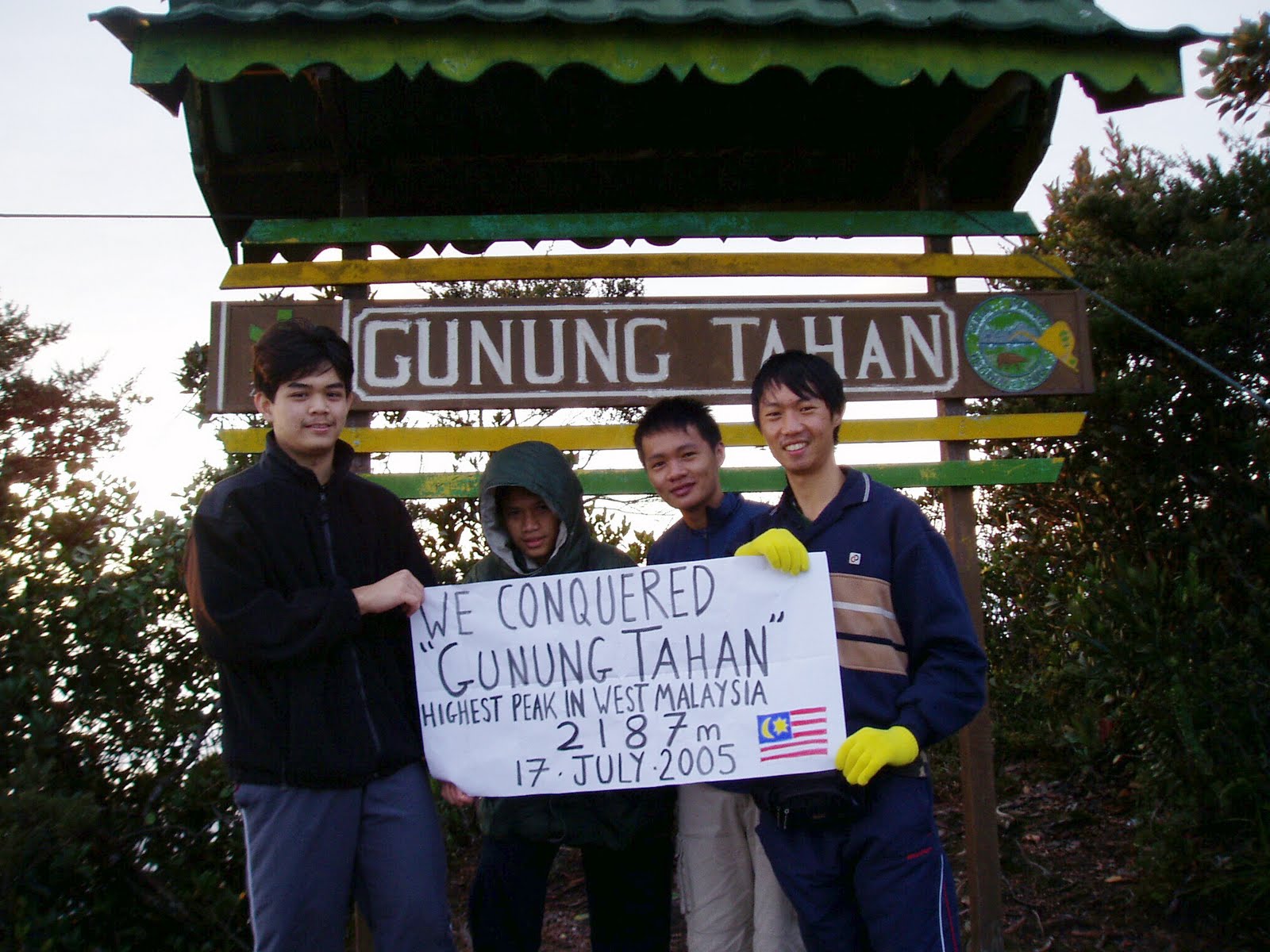 On the summit of Gunung Tahan, the Roof of the Peninsular.

 A "pit stop" at the tree post.


